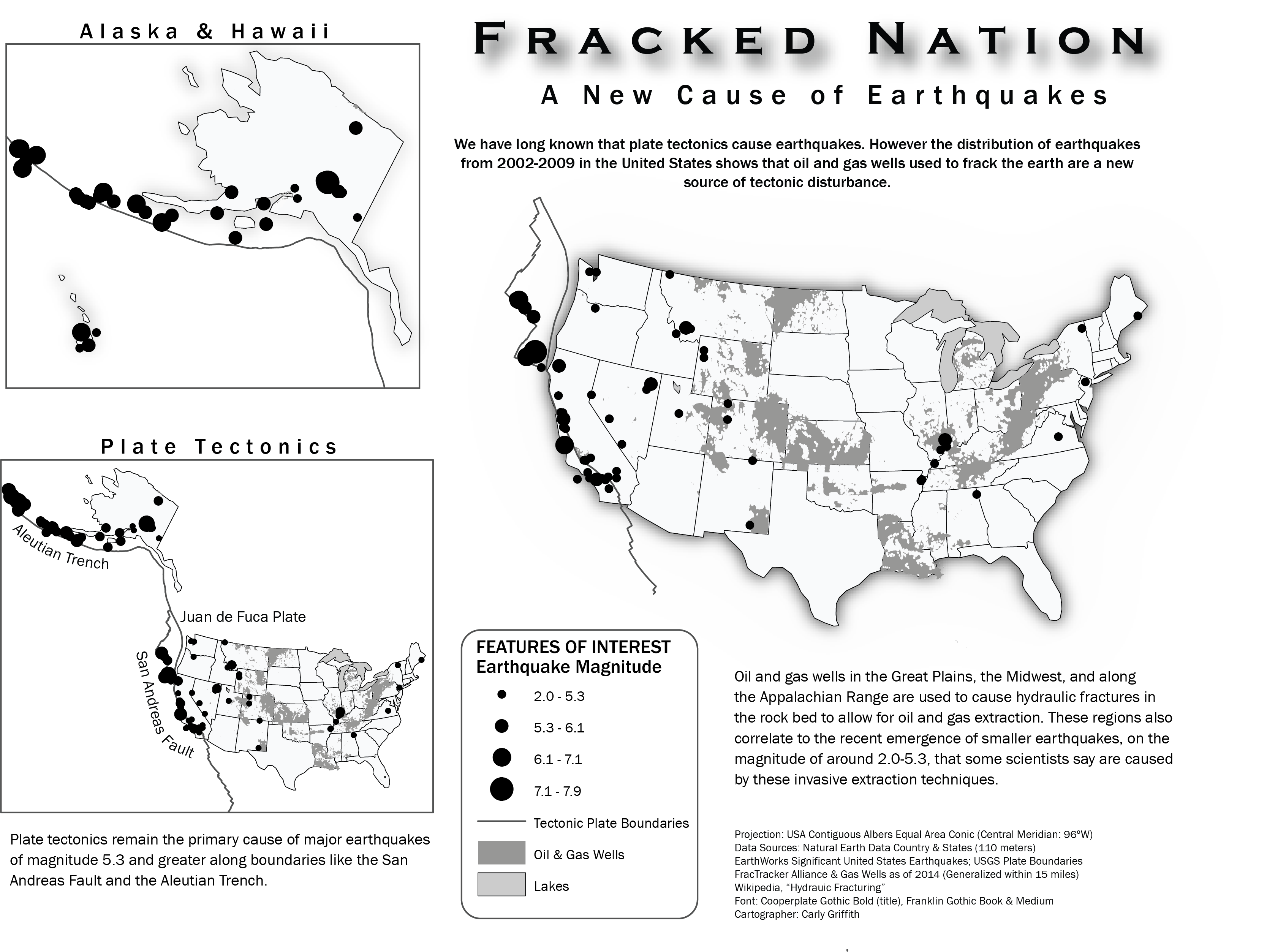
This map uses proportional symbols to indicate earthquake magnitude. It includes the major tectonic plate boundaries to illustrate that the majority of earthquakes, especially those above magnitude 5.3, occur along these fault lines. However, it also includes oil and gas well distribution across the inner continental United States to demonstrate that hydraulic fractures caused by these wells are a new source of tectonic disturbance linked to smaller magnitude earthquakes.