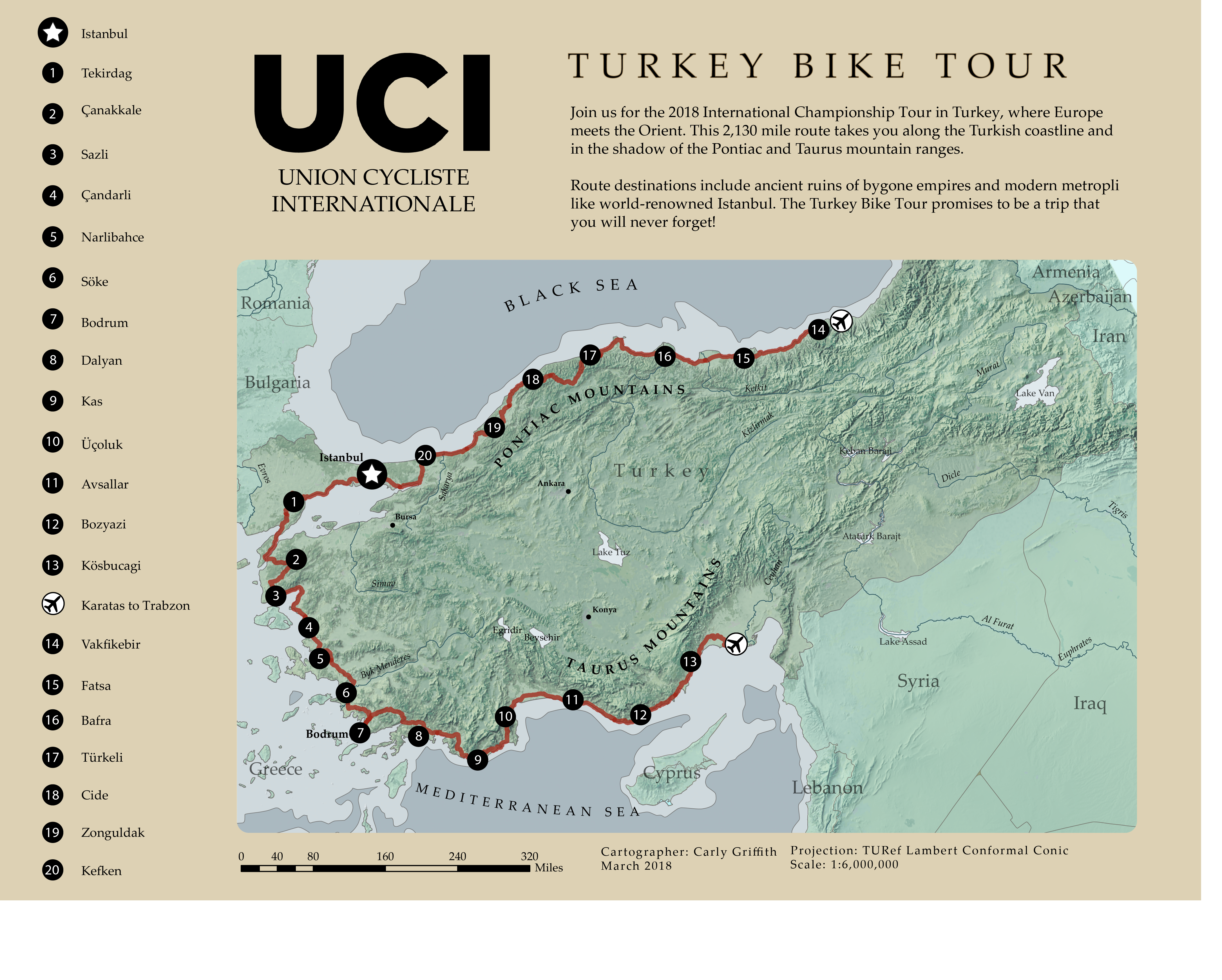
This map combines raster and vector data to represent the terrain of Turkey and the path of an imaginary bike route along its coast. The raster data of the terrain was manipulated in Adobe Photoshop before I combined it with the vector data of the bike route in Adobe Illustrator. I was interested in a realistic depiction that would visually suggest the dramatic terrain the bike route went through.