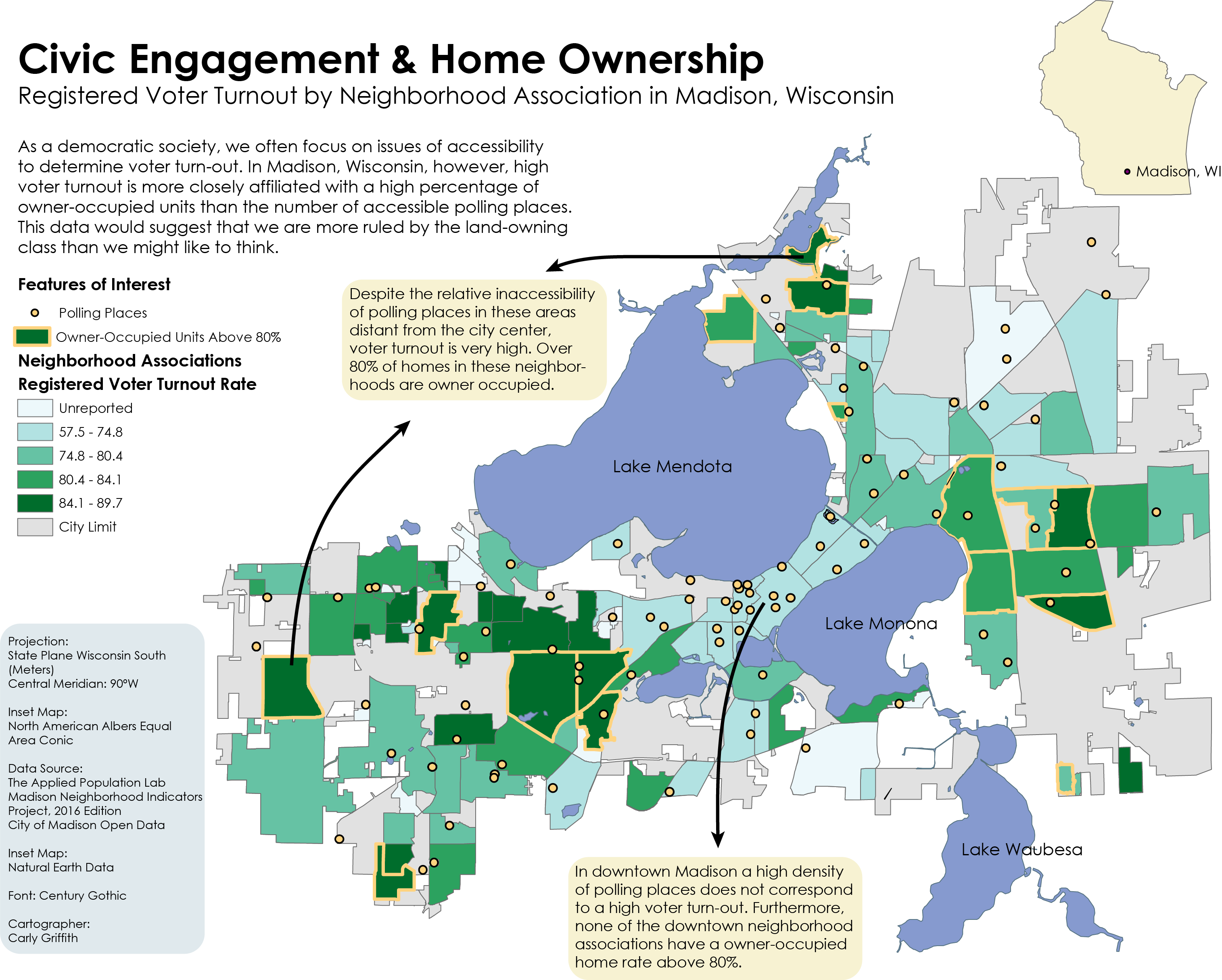
This multivariate chloropleth map combines shaded polygon regions with point data to compare registered voter turnout by neighborhood association to the spatial distribution of polling places. Furthermore, colored borders indicate neighborhoods with owner-occupied unit rates above 80%. This data comparison leads to the conclusion that high voter turnout is more closely affiliated with a high percentage of owner-occupied units than the number of accessible polling places. The map illustrates that multivariate maps can illuminate spatilized relationships we may not be aware of.